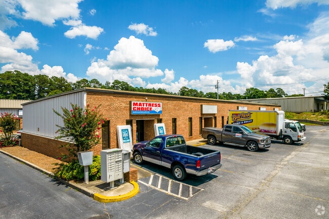
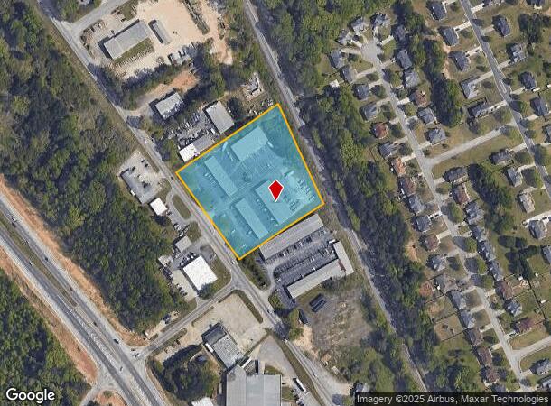
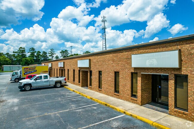
Property Record
9434 S Main St, Jonesboro, GA 30236
NEARBY LISTINGS FOR SALE OR LEASE
Property Detail
9434 S Main St
06-00032-033-009
Clayton
Warehouse
Georgia
X
33
13063C0152F
3.47 AC
2025
S Clayton/Henry Cnty
2025
Atlanta
040627
Atlanta-Sandy Springs-Roswell, GA
9,000 SF
DEMOGRAPHICS near 9434 S Main St
1 Mile
3 Mile
5 Mile
2024 Total Population
4,513
48,226
132,164
2029 Population
4,457
48,141
132,863
Pop Growth 2024-2029
(1.24%)
(0.18%)
+ 0.53%
Average Age
39
37
37
2024 Total Households
1,531
16,480
46,359
HH Growth 2024-2029
(1.24%)
(0.21%)
+ 0.50%
Median Household Inc
$78,323
$65,611
$62,943
Avg Household Size
2.90
2.80
2.80
2024 Avg HH Vehicles
2.00
2.00
2.00
Median Home Value
$208,814
$199,233
$195,259
Median Year Built
1992
1990
1991
Nearby Places
Map Layers
Map Styles
 Street
 Aerial
- Restaurants
- Banks
- Shops
- Fitness
- Groceries
PUBLIC TRANSPORTATION
AIRPORT
Hartsfield - Jackson Atlanta International
DRIVE
WALK
Distance
Hartsfield - Jackson Atlanta International
23 min
13.2 mi
SALE & LEASE HISTORY
LISTING DATE
SALE/LEASE

Sep 25, 2016
For Lease
Dec 22, 2022
For Lease
Nearby Properties
Address
Land Use
TOTAL SIZE
Lot Size
Zoning
Address
Land Use
TOTAL SIZE
Lot Size
Zoning
231,046 SF
97.58 AC
C
Address
Land Use
TOTAL SIZE
Lot Size
Zoning
7,851 SF
94.84 AC
RS180
Address
Land Use
TOTAL SIZE
Lot Size
Zoning
1,140 SF
187.84 AC
MX
Address
Land Use
TOTAL SIZE
Lot Size
Zoning
123,842 SF
31.53 AC
RS110
Address
Land Use
TOTAL SIZE
Lot Size
Zoning
500,415 SF
26.99 AC
HI
Address
Land Use
TOTAL SIZE
Lot Size
Zoning
14,230 AC
C
Address
Land Use
TOTAL SIZE
Lot Size
Zoning
30.90 AC
RS110
Address
Land Use
TOTAL SIZE
Lot Size
Zoning
65,798 SF
7.41 AC
C
Address
Land Use
TOTAL SIZE
Lot Size
Zoning
155,204 SF
21.37 AC
I
Address
Land Use
TOTAL SIZE
Lot Size
Zoning
200 SF
13.12 AC
RM
Address
Land Use
TOTAL SIZE
Lot Size
Zoning
96,315 SF
3.53 AC
RS110
Address
Land Use
TOTAL SIZE
Lot Size
Zoning
56,939 SF
10.04 AC
C
Address
Land Use
TOTAL SIZE
Lot Size
Zoning
21.01 AC
C
Address
Land Use
TOTAL SIZE
Lot Size
Zoning
96,022 SF
5.04 AC
C
Address
Land Use
TOTAL SIZE
Lot Size
Zoning
81,986 SF
15 AC
RS180
Address
Land Use
TOTAL SIZE
Lot Size
Zoning
69,505 SF
10.68 AC
GB
Address
Land Use
TOTAL SIZE
Lot Size
Zoning
55,650 SF
19.71 AC
AG
Address
Land Use
TOTAL SIZE
Lot Size
Zoning
116,822 SF
4.10 AC
RS180
Address
Land Use
TOTAL SIZE
Lot Size
Zoning
184 SF
16.89 AC
C
Address
Land Use
TOTAL SIZE
Lot Size
Zoning
63,256 SF
27.07 AC
I
Address
Land Use
TOTAL SIZE
Lot Size
Zoning
102,653 SF
5.50 AC
ER
Address
Land Use
TOTAL SIZE
Lot Size
Zoning
132 SF
12.70 AC
C
Address
Land Use
TOTAL SIZE
Lot Size
Zoning
2,193 SF
8.49 AC
C
Address
Land Use
TOTAL SIZE
Lot Size
Zoning
196 SF
6.19 AC
C
Address
Land Use
TOTAL SIZE
Lot Size
Zoning
19.35 AC
ER
Address
Land Use
TOTAL SIZE
Lot Size
Zoning
33,619 SF
3.18 AC
C
Address
Land Use
TOTAL SIZE
Lot Size
Zoning
60,200 SF
6.12 AC
C
Address
Land Use
TOTAL SIZE
Lot Size
Zoning
88,942 SF
11.24 AC
C
Address
Land Use
TOTAL SIZE
Lot Size
Zoning
45,862 SF
37.02 AC
RS110
Address
Land Use
TOTAL SIZE
Lot Size
Zoning
44,977 SF
54 AC
OI
The World's #1 Commercial Real Estate Marketplace
Connect with us
© 2025 CoStar Group
The information above has been obtained from sources believed reliable. While we do not doubt its accuracy we have not verified it and make no guarantee, warranty or representation about it. It is your responsibility to independently confirm its accuracy and completeness. Any projections, opinions, assumptions, or estimates used are for example only and do not represent the current or future performance of the property. The value of this transaction to you depends on tax and other factors which should be evaluated by your tax, financial, and legal advisors. You and your advisors should conduct a careful, independent investigation of the property to determine to your satisfaction the suitability of the property for your needs.